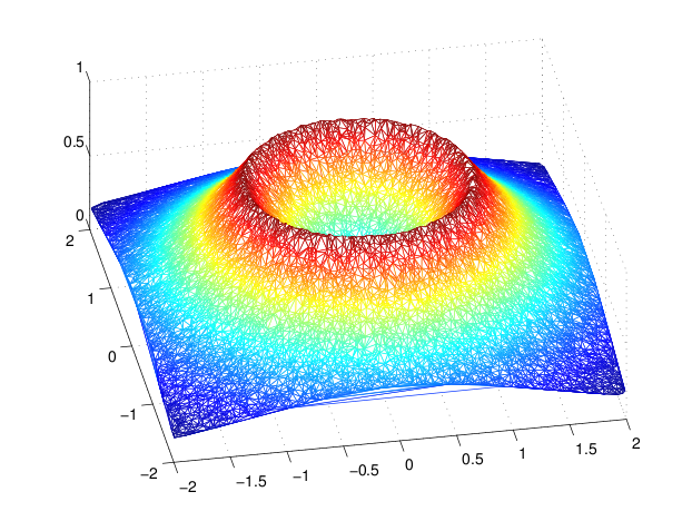
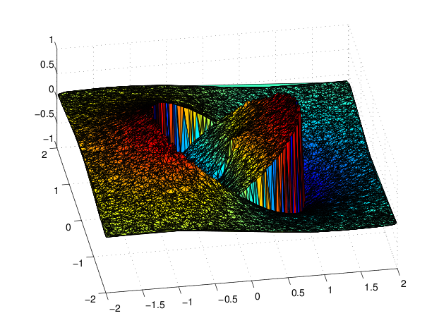
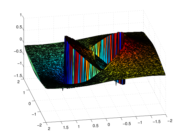
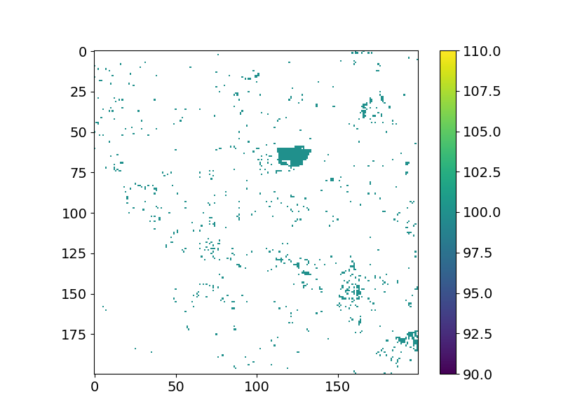
Designed and developed an ensemble based approach for change detection from spatio-temporal stack of satellite images. The approach collates answers from principally different unsupervised and supervised techniques. Here we show comparison the outcomes of the three land change algorithms over two satellite images taken 16 days apart (displayed below)
The figures below illustrate the result of each of the land change algorithm on the input data:
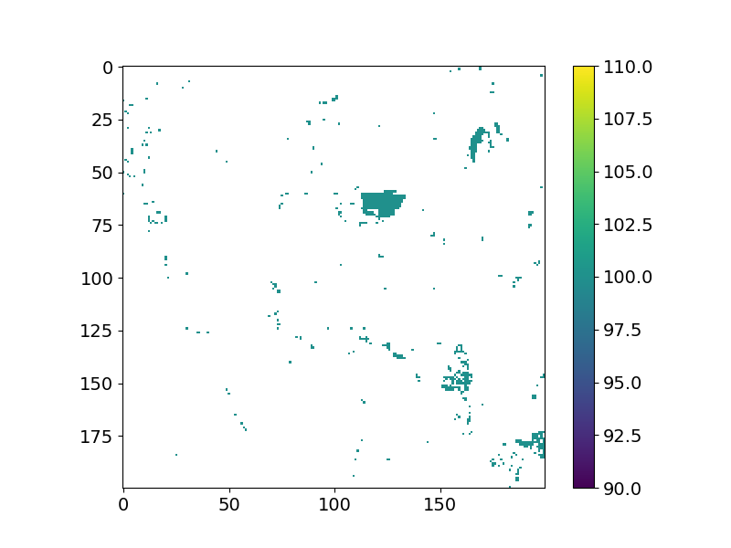
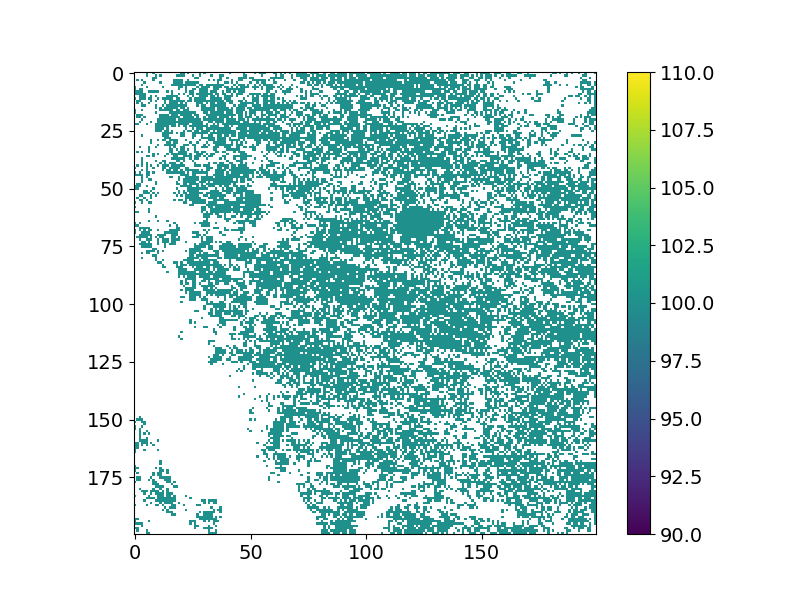
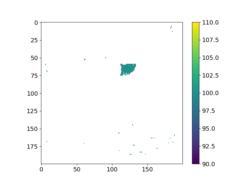
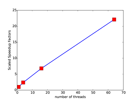
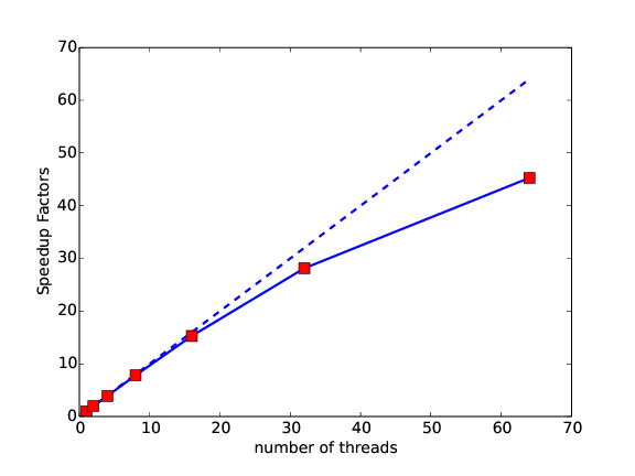
The ensemble method combines results from all three algorithms using Hausdroff distance metric. All the consituent algorithms (ewma, bfast, and landTrendR) were reinterpreted and implemented in interpreted and high performance languages. Big data (i.e., Hadoop implementations were also considered). Below are some of the performance results:
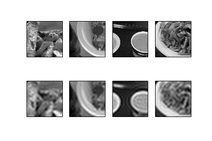
This work studies the use of generalized low rank approximations of matrices for image compression. The approach was proposed in paper titled Generalized Low Rank Approximations of Matrices published in Machine Learning journal. It generalizes low rank approximation to multiple matrices, thus adapting the approach for analyzing datasets of images (rather than having to pro- cess one image at a time). I implemented this approach and run experiments on a fa- cial data dataset that was used by the author as well as and on a remote sensing dataset. Significant compression is achieved Comparison between the results of reconstruction and clas- sification obtained from generalized low rank approximation approach and the results obtained using SVD is also pre- sented; the recontructions with the current approach are much better. The proposed approach also achieves much better time complexity. Since remote sensing datasets, in particular, are plagued by massive amounts of missing data, such methods of compression can be particularly useful to them. Some results are presented below. For a detailed report on the implementation and report see: report.pdf
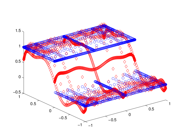
My dissertation mostly focused on the use of polynomials for the purpose of image processing, in general, and edge detection, in particular. Displayed below are some related results from the topics that I have explored so far.